Follow a route without thinking about it
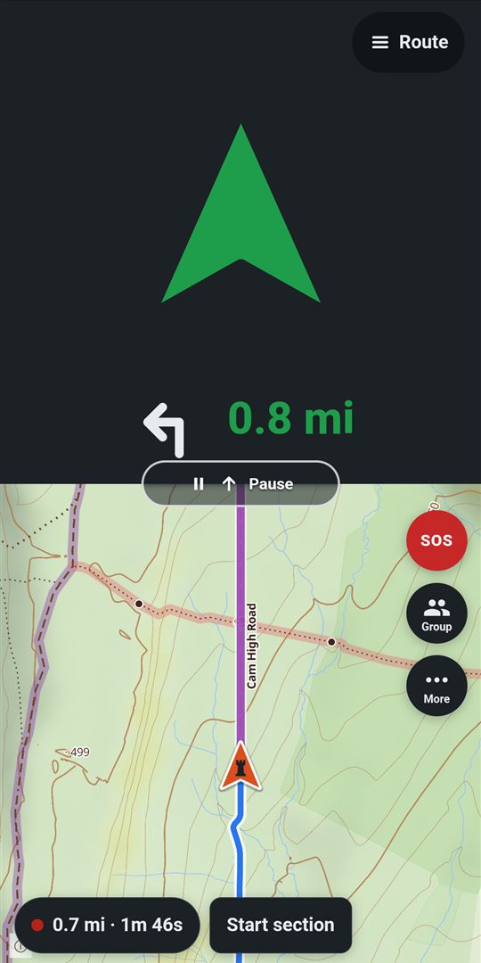
Half the screen is one big arrow you can read in a glance. On the route it's green and points the way the route goes, with the next turn beside it.
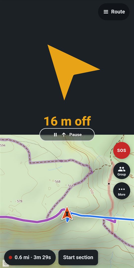
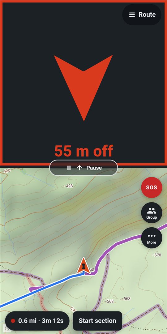
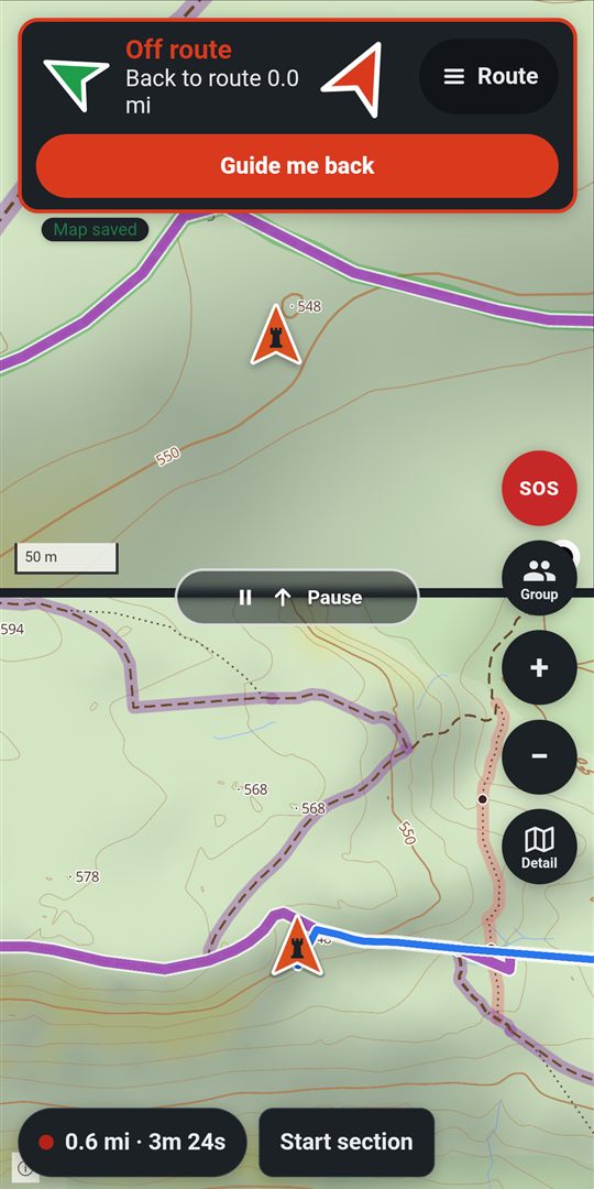
Drift off and it turns towards the route and tells you how far off you are: amber past 10 metres, red past 25. Past 40 metres that half becomes a map of you and the way back, and as you near the route again the arrow comes back. Ride the wrong way and it says so, in red. Prefer more map? Shrink it to a small card and it still pops open when you stray.
Green to 10 m · amber to 25 m · red to 40 m · then the way back · heading-up · two taps to stop
- On the routegreen, within 10 m
- Driftingamber, 10 to 25 m
- Further offred, past 25 m
- Off routethe way back, past 40 m
A map made for green lanes
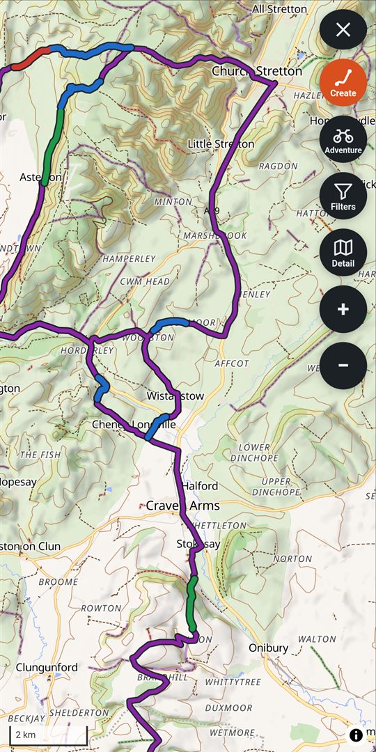
Three maps, one tap apart. Simple shows just the byways and unclassified roads you can ride. Detail adds contours, hill shading, slope, bridleways and every track, coloured by what the law allows and how rough they are. Street is a plain road map. Under Layers, turn each of them on or off, whichever map you start from. All of it works offline.
See a byway you fancy? Tap it to make it a lane. The map splits tracks at junctions, so add the next part and the next until the lane is whole, then count its gates. Your lanes show in their grade's colour, for the bike you ride.
All of Great Britain · Street · Simple · Detail · BOAT · restricted byway · bridleway · UCR
Create a route in a few taps
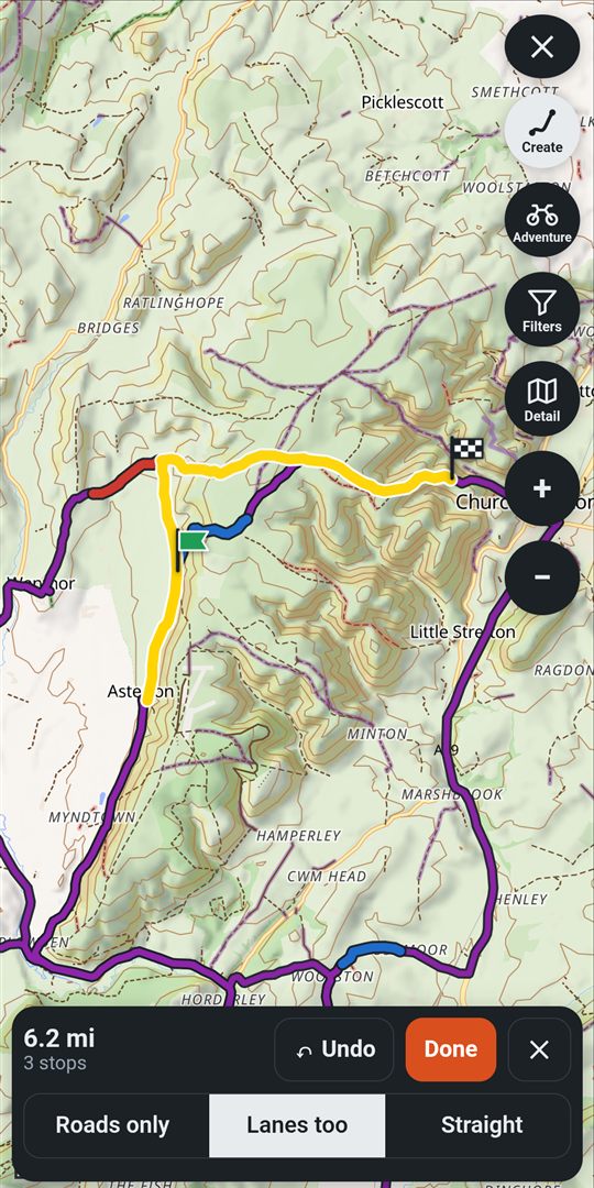
Tap Create a route on the start menu, then tap the lanes you want to ride, in order. RookWild joins them along roads only, or lanes too, in one slim bar that leaves the map clear: the distance as you go, and Undo if you change your mind.
Tap Done to see the whole route, give it a name, and save it ready to follow. Create routes on the website at your desk, and it's on your phone when you head out.
Your sections · any lane on the map · anywhere at all
Keeps working when the signal goes
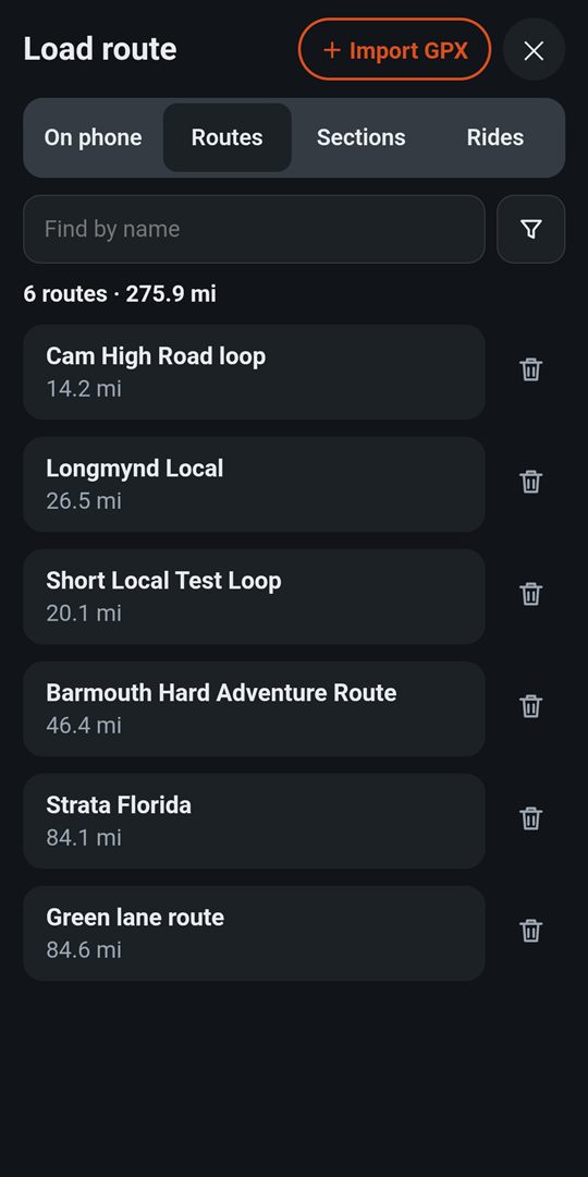
Keep a route on your phone and RookWild saves its line and the map for 10 km either side, so it draws even in the dead valleys. Keep 5 routes at a time for free, or as many as you like with premium.
Finish a ride with no signal and it saves on your phone anyway. It uploads by itself when you're back in range. If the app is closed mid-ride, it asks whether to carry on, save, or bin it.
On a weak signal, every screen shows it's working straight away, says so if the connection is slow, and offers Retry if nothing comes through.
Route map: 400-odd tiles, a few MB · uploads never duplicate
Bring any GPX file
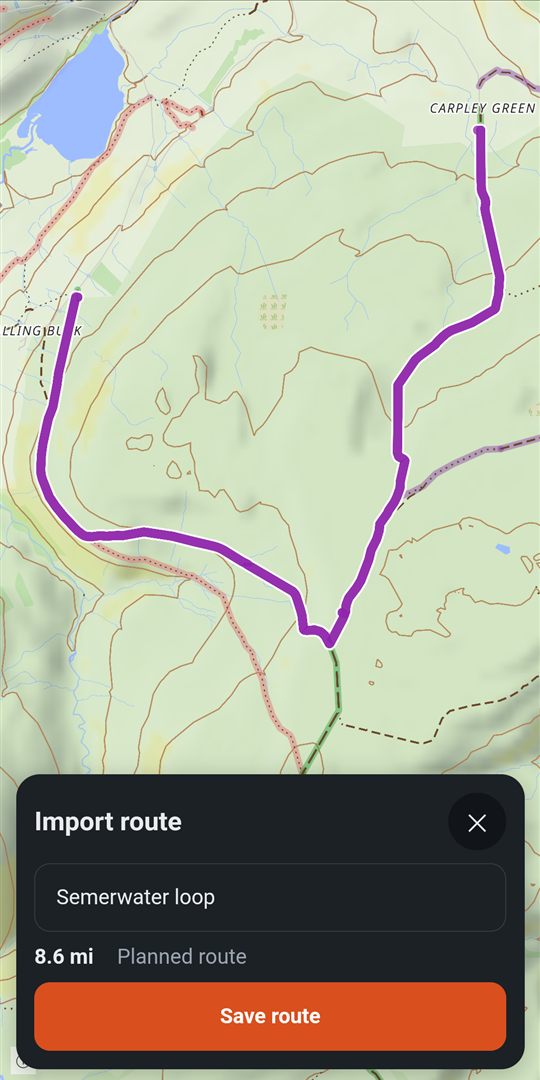
A route from a planning site, a friend's ride, a section of the TET: pick the file from your phone or Google Drive, or tap it in WhatsApp or your email and open it with RookWild.
You see the whole line on the map with its length before anything is saved. Give it a name, keep it on your phone, ride it.
Planned routes and recorded rides · up to 8 MB
Grade every lane
Green, blue, red or black, each way, for an adventure bike or an enduro bike. Grade any lane straight from the map, even mid-ride. A route tells you how hard it will be from the lanes along it. Check a lane's legal status before you ride it.
The ride bar
Three numbers at a glance: how far you've ridden, how far is left, and how far to the next section or point. The map buttons fade to show more map, the map follows you again by itself, and your zoom is remembered.
Hear the turns
Spoken turns and off-route warnings through your headset, or short tones. Off unless you want it.
Battery saver that thinks
It works out whether the battery will last the route. If it won't, the screen goes dark between turns and wakes for each one, by itself; its power button, beside SOS while the battery's low, turns it off or on. Your ride is still recorded in full.
Sections as you ride
Tap Record section at the start of a good stretch and Stop at its end; stopped too soon, tap Resume. Grade it there and then, or after the ride. Or make sections from the ride afterwards, with the gates counted for you.
Map points
Press and hold the map to mark a place to look at later: woods to ask about, a viewpoint. Each is a type of your own, in its own colour. Share with friends or keep it to yourself, add the note later on your PC, and put points in your packs.
Find near you
Fuel, food, garages and your own sections, nearest first, with the way there shown before you go and a link to the opening times.
Ride together
Invite your mates or the whole group to a ride and see each other on the map, with the route and your graded sections along it for the ride. Joining a ride is free; starting one is premium.
Follow the leader
When the leader loads a new route mid-ride, or heads for a section or place, everyone following gets it straight away, without stopping. Go your own way any time, and hand the lead over when you stop for fuel.
Group packs
Your riding group's routes and lanes in one place, on everyone's map. Everyone adds their own, or just the admins; anyone can save a copy. Leave the group and its packs go with you.
Multi-day trips
Stop for lunch or for the night, then resume the saved ride: the whole trip stays one ride, each leg listed.
Share as GPX
Mates on other apps? Send any route or ride as a GPX file from your phone.
SOS
Hold the button and your group sees where you are and what's happened. They reply Seen or On my way. Free for everyone: safety is never paid for.
Pause for fuel
One tap and the arrow slides away while you detour; one tap and the route's back. Off course? Guide me back rejoins the route ahead.
Your garage
Choose the bike as you set off and RookWild keeps the miles and hours for each one, with the grades for adventure or enduro bikes.