Getting started
Five minutes to get set up. One account works on your phone and the website.
Sign in
- Get RookWild from Google Play and open it.
- A few welcome cards. The first asks if you're here to ride, or to be someone's SOS contact: tap To ride (or To be an SOS contact: see Just an SOS contact). What are you on? asks Bike or 4x4: the grades you see, and the app's words, follow it. On Your location, tap Allow location: RookWild needs it to show where you are and record your rides. It asks for notifications too, for invites and SOS.
- Tap Get started, then Sign in or create account. Enter your email and type in the code it sends you. No password to remember.
- Notifications not on yet? A card says what they're for (ride invites, shares and SOS alerts from friends): tap Allow notifications, then allow them when your phone asks. Asked once; Not now and it won't ask again.
- A short tour shows how RookWild fits together: maps, sections, routes and packs. Skip any time.
Tip: want the tour again? Settings, Account tab, Tips: On.
- Go to rookwild.com/app on a computer or tablet.
- Sign in with the same email you use on your phone, and type in the code it sends you.
- Everything you've made on your phone is there: routes, rides, sections, friends and settings.
Tip: the website is made for a bigger screen. On a phone, use the app.
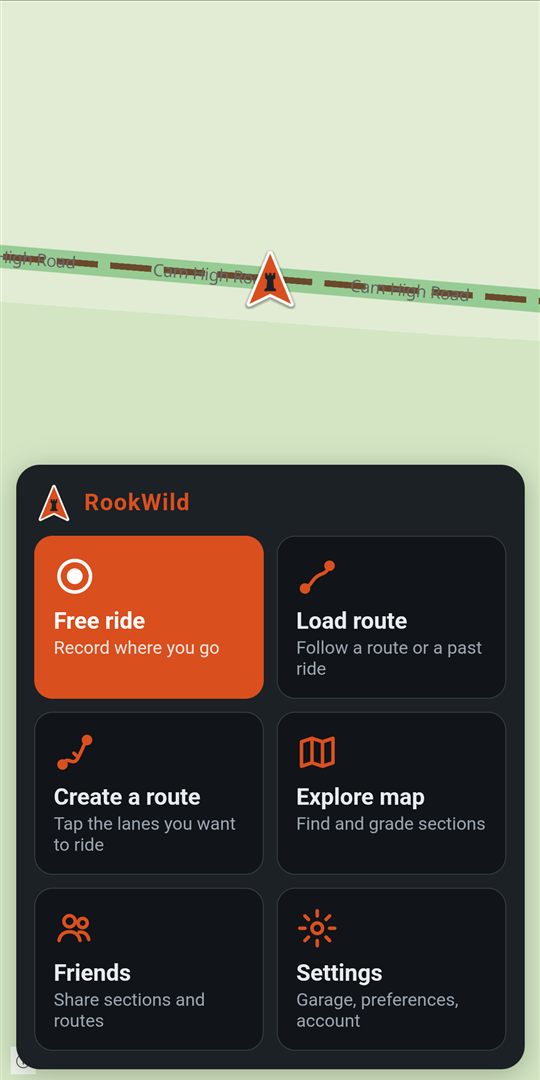
Your bike and its grades
Sections are graded separately for adventure bikes, enduro bikes and 4x4s. A lane that's a blue on an enduro bike can be a red on a big adventure bike, so RookWild shows you the grades for the bike you're on.
- Before each ride, the top of the sheet says Riding and your bike. Tap Change to pick another.
- On a bike that isn't yours? Choose Adventure bike or Enduro bike and the grades still fit.
- Add your own bikes with + Add a bike, and RookWild keeps the miles and rides for each. See your garage.
On Explore and on the riding map, Show, Grades for chooses which grades the map shows.
On a 4x4: tap 4x4 on the start menuchoose 4x4 in Settings, What you ride, or add your vehicle to the garage as a 4x4. A 4x4's grades are kept apart from the bikes'. Where a lane has no 4x4 grade yet, you see its adventure bike grade, faded, as a guide.
- Settings, What you ride: the bike whose grades you see.
- On Explore, Show, Grades for changes it there and then.
- Add bikes in Settings, Your garage: add or change bikes.
Riding
Made for gloves and a phone on the bars. Riding is on the phone; the website is for planning and looking back.
A free ride
No route: just ride. RookWild records the whole ride, screen on or off.
Start menu → Free ride
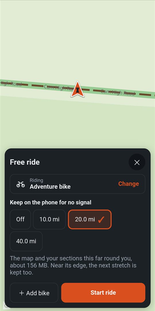
- Tap Free ride.
- Under Keep on the phone for no signal, choose how much map round you to keep: Off, 10, 20 or 40 miles. It says how much room it takes.
- Check your bike at the top, and tap Start ride.
- Ride. There's nothing else to tap.
On the riding screen, down the right:
- SOS: see SOS.
- Group: ride with friends, see ride together.
- Find: fuel, food, garages and your sections near you.
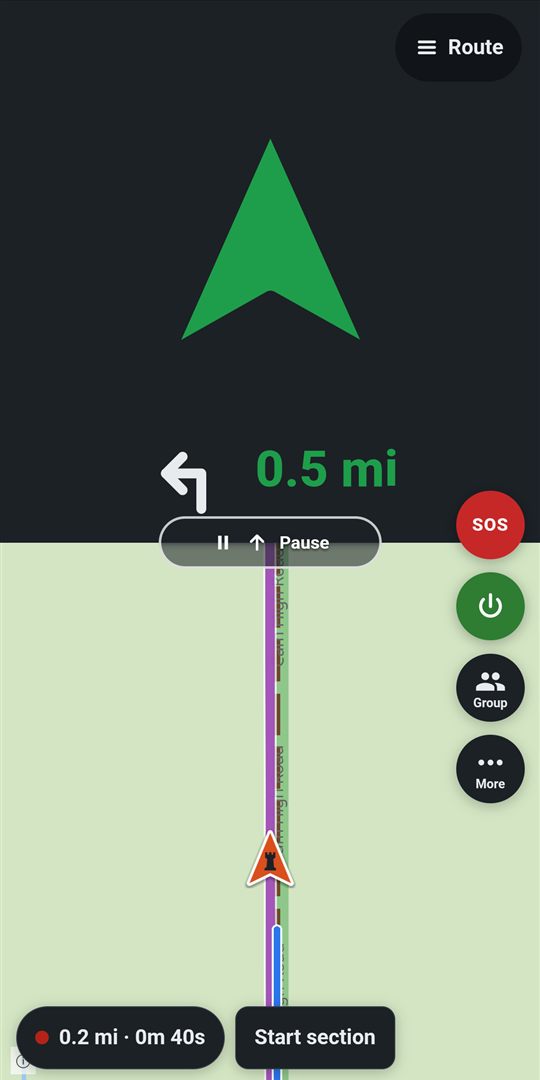
- Record section: tap at the start of a stretch you want to keep, and Stop at its end. See record a section while riding.
- Report: a fallen tree, a flood, a closure.
- Show, the same as on Explore: Grades for your bike (Change changes the grades shown; the ride stays on the bike it started on), Routes from packs and friends on this ride, which packs are on the map, and the map key, half the screen with the map still in view. Tick and see it change; the ✕, Show again or a tap on the map puts it away.
- The map button (it says Street, Simple or Detail): change the map, its layers, heading up or north up.
- + and −: zoom. The map remembers how close you like it: from then on it follows you at that zoom, this ride and the next. A pinch while the map follows you does the same; a pinch after you've moved the map to look around doesn't.
- More (⋯): Load route, battery saver, Record section, Report and Settings, without stopping the ride. On a smaller screen, whatever doesn't fit in the column is in here too: Show, the map, zoom.
- ◎, in place of + and − after you've moved the map: back to following you, and the zoom buttons come back. Meanwhile zoom is under More. You needn't tap it: once you're moving and haven't touched the screen for 10 seconds, the map follows you again by itself (never while a card or menu is open). Choose how long in Settings, Riding, Back to follow me after: Off, 5 s, 10 s or 20 s.
Three seconds after you last touch the screen, the map buttons fade so you can see the map under them. Touch anywhere and they're back; tapping a faded button works straight away. The route arrow and the chip at the bottom never fade, and nothing fades while a menu or card is open.
The small chip at the bottom shows three numbers, such as 12.4 · 18.1 · 0.6 mi: how far you've ridden (by the line), how far to the end of the route you're following (by the flag, only when following one), and how far to the next section or map point ahead (by a dot in its grade's or point's colour). Riding free, the next is the nearest one ahead of you, within about 3 miles. Tap the chip for your time, your speed and Stop.
On the phone only. Rides you record show on the website under Routes, Rides.
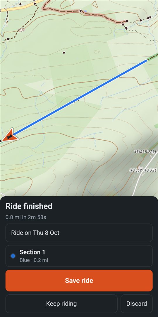
Stop and save a ride
- Tap the chip at the bottom, then Stop, and tap again to finish.
- Name the ride, or leave the date as its name.
- Recorded sections on the way? Sections says how many. Tap the pencil to see them all: name each, grade it, slide its end back if you stopped late, take off a gate, or remove it. Back to the ride.
- Seen by…: who can see it. Tick Hide the first and last 300 m to keep your home private.
- Tap Save ride. No signal? It's kept on the phone and goes up when you're back in range.
- Changed your mind? Keep riding.
- Stopped for lunch, or riding a trail over several days? Save it, then Load route, Rides, Resume. It stays one ride, each leg listed. This works with no signal too, while the ride is still waiting to upload: it goes up once, as one ride, when you save it again.
- Phone died or the app was closed? Next time it asks: Resume ride, Save it now or Discard.
Afterwards, open the ride from Load route, Rides, to make sections of the best stretches, or Save as a route to ride it again.
- Routes, the Rides tab: every ride you've saved.
- The ⋯ on a row: Save as a route, Show on map, Share, GPX, Edit (its name and who sees it, on the whole screen), Seen by or Delete.
Record a section while riding
Riding a stretch worth keeping? Mark it as you go, with or without a route, and grade it now or when you save the ride.
- At the start of the stretch, tap Record section in the buttons down the right (on a smaller screen it's under More).
- It turns into a red Stop with the section's time. At the end of the stretch, tap Stop. Section saved shows for a moment, and is said if you hear the prompts spoken (a tone with tones).
- Stopped too soon? For a few seconds the button says Resume: tap it and the same section carries on. How long is in Settings, Riding, Resume after stopping a section: 3, 5 or 10 seconds.
- Then a card asks: Enter information to name the section, grade it, say what it was like and count its gates, then Save; or Later. Either way the ride carries on recording.
- When you save the ride, Sections lists them: see stop and save a ride.
On the phone only. Make sections from a saved ride or the map on Explore: see make a section.
Load a route
Start menu → Load route
- The tabs: On phone (kept for no signal), Routes, Sections and Rides.
- Type in Find by name, or Filter by length and order.
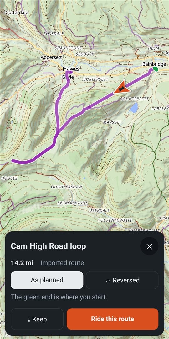
- Tap a route. It opens on the map with its card, the same card wherever you open a route: see a route's card.
- Riding it the other way? Tap ⇄ Reversed. The green end is where you start.
- Tap ⤓ Download for offline, under its facts, to keep it on the phone with its map for no signal. Once it's done, the card says ✓ Offline ready.
- Tap Navigate for the arrow and turns, or Just show the route for only the line on the map, like a paper map. Check your bike, Start ride. Your choice is remembered as the main button next time.
Share on the card shares it with friends, as GPX, or into a pack. Packs: all, under the tabs, chooses which packs' routes are listed; narrowed, it says how many, such as Packs: 2 of 5.
Already riding? More, Load route: the same screen, with On phone, Routes and Rides. Tap one and it's followed straight away, the way round you last chose. Your ride keeps recording as one ride, and a group ride carries on. If you lead a group ride, everyone following switches to it too: see ride together.
- Routes in the top bar: a table of your routes, with Rides beside them.
- The ⋯ on a row: Show on map, Share, GPX, Edit (its name, who sees it, its grade and packs, on the whole screen), Seen by, Delete.
- To ride it, open Load route on your phone: it's already there.
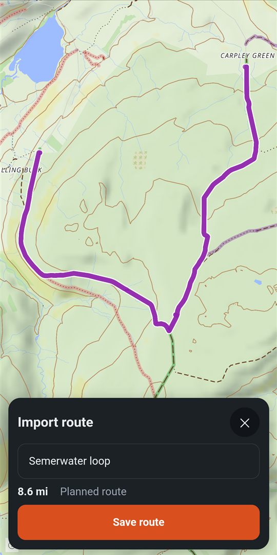
Bring in a GPX file
Routes from a club, a guide, a mate or another app. RookWild reads any GPX file.
- In WhatsApp, an email or your files, tap the .gpx file and open it with RookWild (on an iPhone, Share, then RookWild). Or Load route, +.
- Name it, and say whether it's a Recorded ride or a Planned route.
- Save to: choose a pack, or leave it in My Lanes.
- Tap Save route. Its card opens, ready to ride.
Straight into a pack: open the pack, + Add, A GPX file. See add to a pack.
- Routes, then drag GPX files onto Drop GPX files here, or choose files.
- Bring in a whole library at once: many files, up to 30 MB each.
Straight into a pack: Settings, Packs, open the pack, + Add, GPX files.
Follow a route
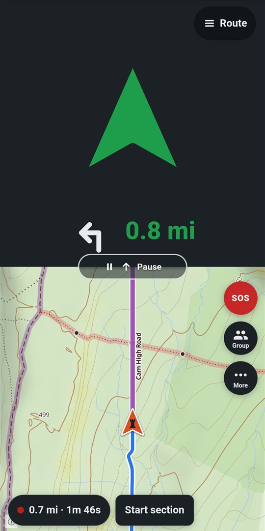
Once you've tapped Navigate, a big arrow shows the way, with the next turn beside it.
The route line shows which part you're on, even where it comes back along the same lanes or crosses itself: what you've ridden is faded grey, the stretch ahead is bold with arrows, and the rest of the route is faint. The app follows you from the start, the way you're going, so the way back down the same lane isn't mistaken for yours.
- Green: you're on the route.
- Amber, then red: you're drifting off. It turns towards the route and says how far off you are.
- Wrong way: you're riding the route backwards.
- Your sections ahead are announced as you reach them, with their grade, terrain and gates.
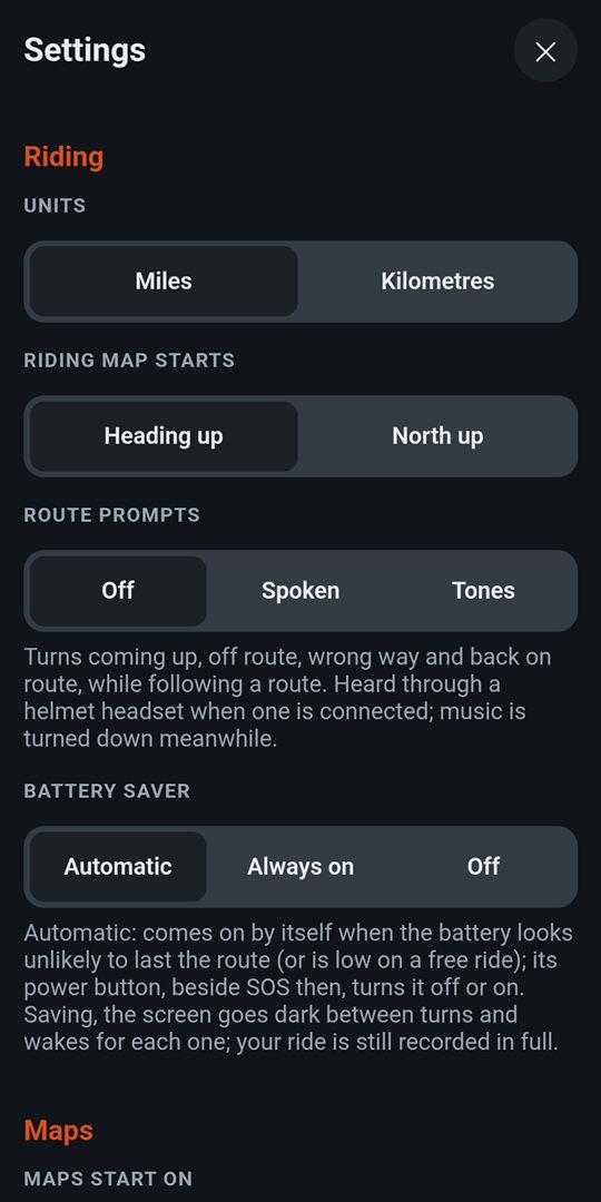
Turns can be spoken or played as short tones, through a helmet headset if one's connected: Settings, Riding, Route prompts.
Choose the arrow in Settings, Riding, Navigation arrow: Big, Small or None, one choice for each of spoken prompts, tones and no sound. Hearing the turns, you might not want the arrow at all: with None you get more map, and a small card still comes if you go off the route or the wrong way. The big arrow takes A third of the screen or Half. With the phone upright it sits at the Top or the Bottom.
The Route button: Just show the route, Make the arrow small, Hide the arrow (or Show the big arrow), or Stop following (two taps; the ride keeps recording).
At the end it says Route complete. Then stop and save as usual.
On the phone only. Plan the route on the website, then ride it from Load route on your phone.
Off the route
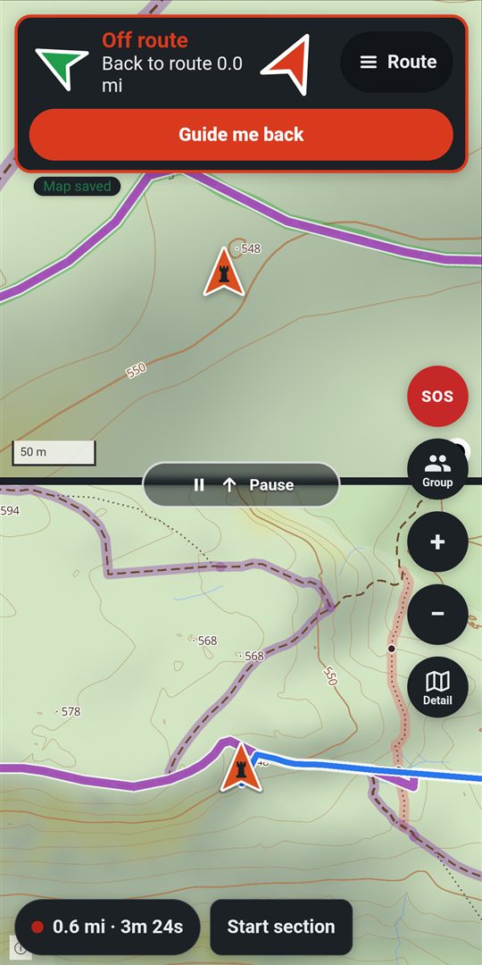
- Go well off the route and the arrow goes red and points back to it, saying how far.
- Tap Guide me back: it finds a way along roads and lanes to the route ahead, and switches back to the route once you're on it.
- Or let it: stay off the route for a while and it finds the way back by itself. Choose how long in Settings, Riding, Reroute when off route, or Off.
- Know where you're going? Cancel reroute leaves you to it.
- Gone another way for good, say the group's leader changed the plan? After it's rerouted you 3 times without you getting back to the route, navigation pauses by itself and your ride keeps recording. Tap Navigate when you want the route again. Choose how many times in Settings, Riding, Pause after rerouting, or Never.
On the phone only.
Pause for fuel
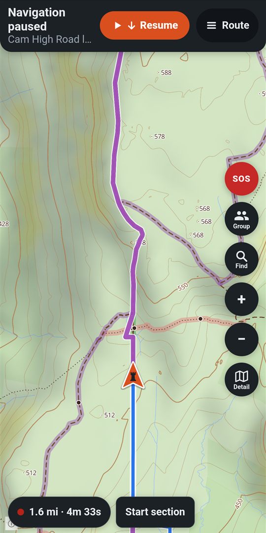
- Tap Pause on the line across the screen, or Route, Just show the route. The arrow slides away and the map is yours, with the route still on it. Your ride keeps recording.
- Tap Find for fuel or food, and Navigate me here.
- When you get there, it offers the way back to the route. Or tap Navigate on the Just showing the route banner.
On the phone only.
Find fuel, food, garages and lanes
Riding → Find (on a free ride, or with the route paused)
- Choose Fuel, Food & shops, Garages or Sections, nearest first. Or search by name.
- Nothing close? − and + change how far it looks.
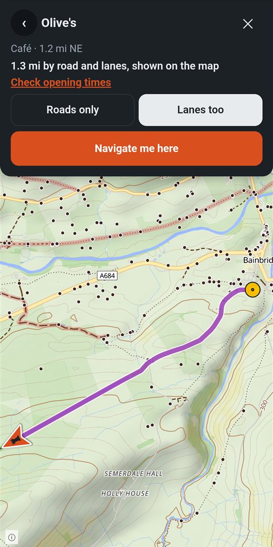
- Tap one: the way there is drawn on the map, with how far it is.
- Check opening times opens it in Google Maps.
- Choose Roads only or Lanes too, then Navigate me here.
Tip: tap a section, a lane or a place on the map to see it first: a section shows its grades, and the map stays where it is. Navigate me here then takes you there. Or, with Find open, press and hold anywhere (with Find closed, pressing and holding the map adds a map point).
Lanes too leaves out lanes under a TRO (yours, a pack's, or one riders have confirmed; a possible TRO is only warned of), and the lanes your vehicle avoids. If only those go there, it says so: Try without them finds a way anyway.
Your own sections on a footpath, bridleway or restricted byway are left out too, as the map's are, unless you turn on Use my sections where the map says no motor vehicles in Lanes to avoid. Turn it on only if you have the right to ride or drive them: the landowner's permission, a private right of way, or the map is wrong. Only sections you made are used, never a pack's or a friend's, and never one marked with a TRO. Before a way that uses one, RookWild names each with what the map says: Go anyway or Avoid them. On the way they're drawn in orange and white dashes, and their card says Yours: the map says bridleway.
On a 4x4: the map doesn't know every lane's width yet, and RookWild says so: check width before you go.
On the phone only. On the website, Explore's Search finds places, routes and sections on the map.
No signal
Lanes are often out of signal. RookWild keeps what you need on the phone:
- Routes: ⤓ Keep on a route's card keeps it with its map. The On phone tab in Load route shows each one's map as ready, or still coming. Once a week or so the base map is renewed: on Wi-Fi the newer map comes in by itself and it says map updating; the one you have keeps working with no signal until it's done.
- Free rides: the map round you, as far as you chose when you started.
- A whole area (premium): Settings, Maps, Keep an area, chosen on the map. Move and zoom the map until the circle holds it, up to about 62 miles across, then Keep this area.
- Rides wait on the phone and go up when you're back in range. The start menu says how many are waiting, and they're at the top of Load route, Rides, marked Waiting for signal to upload. Open one to see it on the map; sections and sharing come after it uploads.
- Find, navigation and your sections all work from what's on the phone.
Free keeps 5 routes on the phone; premium as many as you like. To free up room: Settings, Maps, Kept for no signal.
On the phone only.
Battery saver
Following a route, RookWild works out whether the battery will last to the end. If it won't, the battery saver comes on by itself. On a free ride it comes on when the battery's low.
- The screen goes black between turns, and wakes before each turn, if you go off the route, or when you tap it.
- Your ride is still recorded in full.
- A power button beside SOS turns it off or on. Or More, Battery saver on.
- Settings, Riding, Battery saver: Automatic, Always on or Off.
On the phone only.
Lanes and routes
Find the lanes, say what they're like, and join them into a day out. All of this works on the website too, on a big screen.
Explore the map
Start menu → Explore map
Top bar → Explore
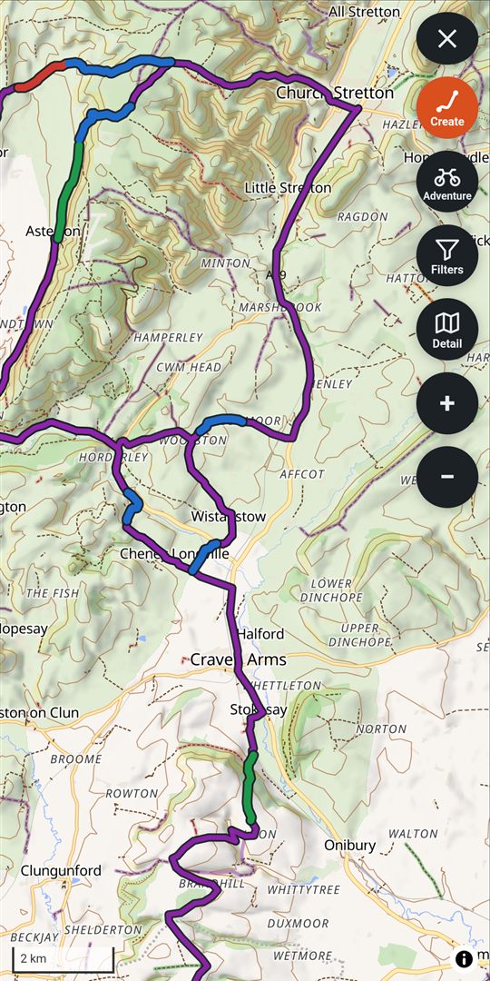
- Three maps, from the map button: Street for roads and places, Simple for just the lanes you can ride, Detail for every track, with contours and shading. Layers picks what's drawn.
- Show: Grades for, whose grades you see (adventure, enduro or 4x4), your Routes and Sections, Parking, which packs are on the map, and the map key, half the screen with the map still in view. Changes show at once; the ✕, Show again or a tap on the map puts it away.
- More (⋯): Create, to create a route, and Add parking, to add where to leave the van. On a smaller screen, whatever doesn't fit in the column is in here too: Show, the map, zoom.
- Search: its own screen. At the top, Where I am or Middle of the map, and it says where it's looking, such as Looking near the middle of the map, by Stoke-on-Trent. Type a name to find places, your routes and sections (a route or section found opens its card), or use the tabs, as Find has them: Fuel, Food & shops, Garages and Sections, nearest first, with − and + for how far to look. With a route on show, each place says how far off the route it is. Typing fuel, food or garage offers that tab straight away. Zoomed right out, your sections aren't drawn until you zoom in.
- A route's card is the same wherever you open a route (Explore, Load route, the riding map) and whoever's it is (yours, a pack's, a friend's). From the top: its name, with ⌄ to shrink the card to that one line (and back) when you want more of the map, and the ✕. Report, Edit (its name, grade, notes and packs, or Delete route) and Share (who sees it, your packs, friends and groups, Share as GPX, all on one screen); Share is greyed out on a route that isn't yours. Its grade, length, climb up and down (↗ ↘) and about how long it takes at your pace. ⤓ Download for offline (in the app), or ✓ Offline ready once it's on the phone with its map. A line for anything to know first: a TRO on it, riders' reports along it, a Community note. A small height profile. As planned or ⇄ Reversed, which moves the start and finish flags. Stops along the route: how many fuel and food stops are kept with it and how far their detours add, each shown on the map with its detour; the pencil opens the list. Parking: where you've chosen to leave the van; see where to leave the van. More details. Then Navigate or Just show the route, straight to choosing your bike and setting off (in the app).
- More details shows it all on the whole screen: its notes, the full height profile and each section on it, to tap. Under the profile are its gates, cattle grids, barriers and streams, counted, and a list of its fords, tidal stretches and riders' reports with how far along each is (five, then Show all); tap one and the map shows it, the card shrinking to its name, what it is and how far along, and a small strip of the profile with its line lit; Back returns to Details, and Back again to the card with the whole route in view. A section's card has a small profile and Details too, where every gate, ford and report along it is listed and marked. Below that, What the map says gives what OpenStreetMap says along the section a stretch at a time, as a section can be several tracks on the map: each stretch's status and number, what it says of motor vehicles, its surface and width where mapped, and any part with no track on the map; tap one and the map shows that stretch. It is read from the map itself, so it is left out offline where the map isn't downloaded.
- A pack's or a friend's route isn't yours to change: Edit says so, with Save a copy and edit it (to the pack you last saved to; choose another under More details). Your copy opens to edit, and its pack comes on on the map. Saved again, it says it's already there.
- Want a pack's or a friend's route in one of your packs? More details, then tick the pack. It's linked there, not copied, so it stays as its owner keeps it, and says Linked in your Wales trip pack. If they ever delete it, you keep your own copy in the same pack.
- Riding, with routes switched on in Packs: tap a pack's or friend's route on the map for the same card, with Follow this route to follow it from where you are.
- Report marks show what riders have seen on the lanes: see reports. Report on a section's or a track's card reports something there, where you tapped on its line.
- Where it starts: on the phone, where you are, with your arrow pointing the way you face as it does when you ride (if your location isn't known yet, your home, then where you left it last; it moves to you once your location comes, unless you've moved the map). On the website, where you left it last; else your home. Your home is set in Settings, Maps, Home, and marked on the map with a small house that only you see.
Choose which map Explore and the riding map start on: Settings, Maps, Maps start on.
Choose which map it starts on: Settings, Maps start on.
Every green lane, for everyone
Two packs are on your map from the start: UK Green Lanes, every byway open to all traffic and unclassified county road in OpenStreetMap, and UK Unrecorded Lanes, tracks with no recorded right of way that the map says vehicles may use. Both are refreshed each week. Take one off in Packs and it stays off.
- Tap a lane for its card: its length, climb, gates and legal status, and what riders say of it. That's the grade most riders gave it on your vehicle, such as Riders say Red (shown once three have graded it; where they don't agree, the spread, such as Riders differ: Green to Black), and their tags, such as Muddy. Nobody's name is shown. These come from riders and OpenStreetMap, not RookWild: check signs and closures, and ride at your own risk.
- On the map, a lane riders have graded is drawn in their colour for the vehicle in Grades for (the middle of their grades), and one many ride is drawn wider. Its card says how often, such as Ridden 14 times by 6 riders in the last 90 days.
- An unrecorded lane says so: Not recorded as a right of way. It may be private or closed, so check the council's List of Streets before you ride it.
- Know it's legal? If the council's records say it's a byway or an unclassified road, open its card, Details, then Suggest it's legal (also on a track the map has as a bridleway or footpath). Choose which, and give the council's reference or a link to its definitive map or List of Streets. An admin checks it; if it's right, it's put right on OpenStreetMap and shows on everyone's map within a week or two. Its card says how your suggestion stands.
- The pencil on its card: grade it, tag it, count its gates, rename it or put it in one of your packs. What you set is yours; the lane stays everyone's, its line and facts kept up to date from the map. Your grade counts towards what riders say, without your name. It's listed in your sections; Remove from your sections takes what you set away again. Ride and grade a stretch of one, and it's the same: yours, on that lane.
- Details, Add the next part: the map often splits one lane in two where a road touches it. Tap it, then tap the part that carries on from it, and they become one section for every rider. Only parts that meet end to end, and only lanes from the same pack, can be joined.
Make a section
A section is a stretch of lane you know: graded, with its terrain and gates. They're the building blocks of RookWild.
From a lane on the map:
- On Explore, zoom in and tap a byway or track. Its card shows its legal status, how often riders use it, its climb up and down and a small height profile with its gates and fords. If one of your packs has it as a section, even a pack you've switched off, the card says In 1 pack: with the pack's name (with many, the first two and +4, which shows the rest): tap one to see that section. Details shows it all on the whole screen. A track the map marks as not open to motor vehicles says Not used in navigation.
- Tap Make it a section. Want more of it? Add parts, tap the next part, then Done: the card's climb and profile are then all the parts together, before you make it a section.
- Give it a name, count the Gates, and grade it if you know it.
- Save to a pack if you like, then Save the section.
From a ride or route: tap it on Explore, then + Section. Tap where the section starts, then where it ends.
While riding: Record section, then Stop: see record a section while riding.
Check before you ride: the map's legal status comes from OpenStreetMap. It's a guide, not a right of way, so check for closures.
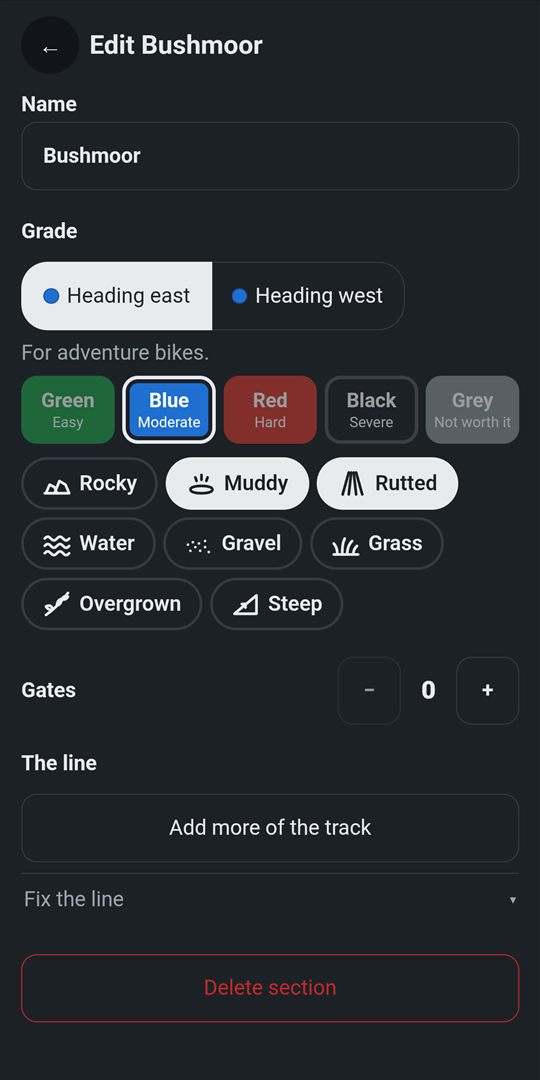
Grade a section
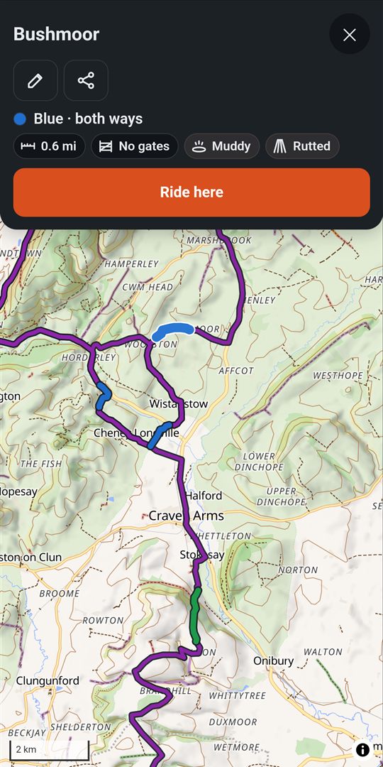
- Tap your section on the map, then the pencil.
- Saved a copy of a pack's or a friend's section with Save a copy, or tapped the pencil on one of the map's green lanes? Its edit screen opens straight away, and the pack you saved it to comes on on the map. Saved again, it says it's already there.
- Under Grade, choose which way, or Same both ways.
- Pick a grade: Green · Easy, Blue · Moderate, Red · Hard, Black · Severe, or Grey · Not worth it. Tap it again to clear it.
- Tick what it's like: rocky, muddy, rutted, water, gravel, grass, overgrown, steep.
- The grade is for what's in Show, Grades for: adventure, enduro or 4x4. Each has its own grades, so grade it for another too, if you know it.
On a 4x4: three more to tick, which only drivers see: Narrow, Overhanging and Not for 4x4s.
Under a TRO? Tick TRO (permanent) or TRO (temporary) for a lane a traffic regulation order closes to motor vehicles. Everyone sees these, on a bike or in a 4x4: the lane is drawn on the map in red dashes, Lanes too leaves it out, and a route along it says so when you look it over, when you set off, and in red as you come up to it. On the route's card, tap the warning (Show › at its end) to see the lane on the route, in red. With more than one, it says 2 lanes · Show › and opens Details, where each lane is listed under the warning, such as Hollow lane · Permanent TRO · At 12.3 mi: tap one to see it. Avoid it finds a way round on the map, back onto your route wherever adds least, drawn in light blue, and says what it adds, such as Way round: 2.4 mi longer, or what it saves, such as Way round: 0.6 mi shorter (or No way round on the map here.). Use this way takes it for this ride only: Navigate then goes the way round, and your route stays as it was unless you tap Save as a new route. With more than one lane, Avoid them all takes a way round each, and says which, if any, has none. No way round? Navigate me here takes you from where you are to the far end of the lane, then on along the route. A pack's or friend's route has the same warning, Avoid it and Use this way; there Save as a new route saves your own copy with the way round. As you ride, a lane marked with a TRO on your route is drawn on it in red dashes. A lane marked with a TRO stays red when you tap it. Ticking one asks Tell other riders?: Yes reports the lane closed for everyone (for a temporary one, until the date you give; a permanent one is a possible TRO until another rider confirms it), Not now keeps it to your section.
The same screen renames it, changes who sees it, adds more of the track, fixes its line from the times it's been ridden, or deletes it.
Mid-ride: tap your section on the riding map, then the pencil. Its grade, ground and gates open on the whole screen while the ride goes on: Save at the top keeps them, Back leaves it as it was. Free riding or navigating, the same pencil is on a lane on the map, or a pack's or a friend's section: grade it and Save, and it's your section, in your sections.
Ride here on its card finds the way there from where you are.
Create a route
Start menu → + Create a route, or Explore → More → Create
Top bar → Create a route
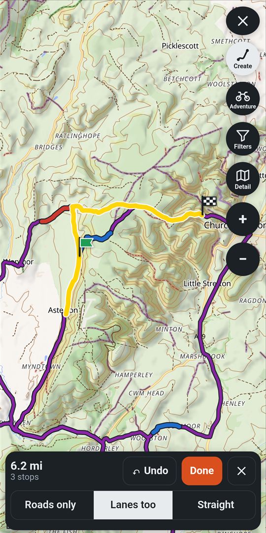
- Tap where you'll start: one of your sections, a lane, or anywhere. A green flag marks it.
- Tap where you'll go next, in the order you'll ride them. RookWild joins them up.
- Choose how it joins them: Roads only, Lanes too, or Straight lines.
- Want a loop? Tap the start flag again. Wrong stop? ↶ Undo.
- Tap Done. Name it, choose a pack to Save to, and Save route. Stops along the route shows fuel and food on the way first.
Free routes have up to 8 stops; premium as many as you like.
The joins leave out lanes under a TRO and the lanes your vehicle avoids.
On a 4x4: the map doesn't know every lane's width yet: check width before you go.
Fuel and food on the way
Create a route → Done → Stops along the route, or the pencil by Stops along the route on any route's card
While you create a route, fuel stations (a pump on blue) and cafés, pubs and restaurants (a cup on orange) within a kilometre of it show on the map. Tap one to make it your next stop.
- Tap Done, then Stops along the route. It lists them in the order you'll pass them, each by its name and the town or village it's in (such as Jet, Llanidloes), with how far along and how far off the route it is, and its opening hours where known: Fuel and Food. It looks within a kilometre of the route; with no fuel that near, it looks further by itself (3, 5, then 10 km) and says how far, with − and + to change it.
- Tap a place's name to see it on the map, with the detour from your route to it and back drawn in light blue, so you can see whether it's a big or small diversion. Only the way off your route and back is drawn, in one piece; a place on the route has none. Where there's no road from where your route passes nearest, the detour is from your route a little further along. The card says how much it adds, such as Detour 1.2 mi there and back, and so does its row. Where the map has no road to it, or the map there isn't on your phone and there's no signal, the detour is a dashed straight line and the card says so. Back returns to the list.
- Add puts one in your route where you pass it. Changed your mind? Keep adding, then ↶ Undo.
- Set your fuel range and the list warns you of any stretch with no fuel longer than it, such as No fuel for 140 miles; your range is 120., with where it is. Show on map draws it in red.
Routes you've saved or brought in (a TET file, say) have the same list from the pencil by Stops along the route on their card, which says how many fuel and food stops are kept and how far their detours add. Add keeps the stop with the route, Remove takes it off, and the route's line stays as it is. Its stops show on the map, ringed in white, whenever the route does, and on the riding map while you follow it, a pump or a cup; with no signal too, once you've seen them. The stops go with the route when you share it as GPX, as waypoints, and come back when a RookWild GPX is brought in.
A pack's or a friend's route has the same list, with Add and Remove too, and no need to save a copy. The stops you add are yours alone on it: the route stays as its owner made it, and nobody else sees them. They show on the map and, while you follow it, on the riding map, as on your own routes.
No signal? Add or remove stops anyway: they're kept on your phone, it says so, and they're saved as soon as you have signal.
Fuel range for: at the top of Fuel, choose what the warnings are for: Enduro bike, Adventure bike, 4x4, or one of your vehicles in My Bikes. For the first three, the range box beside it starts at a typical range (an enduro bike 60 miles, an adventure bike 130, a 4x4 250); change it and the warnings change at once, and it's kept for next time. A vehicle from My Bikes uses its own fuel range, else a typical one for its type, with Set fuel range. With nothing chosen, it's the vehicle chosen in My Bikes, else what you're riding. It counts from the start, so fill up before you set off, and it keeps 15% of your range spare: lanes, a headwind or a heavy load use more fuel than the road.
Stations you can't count on: one not open round the clock, or whose hours aren't known, may be shut when you get there. If a stretch is only short enough because of one or two of them, the list says so in amber, such as Depends on Jet, Llanidloes (hours unknown). Without it: 95 miles with no fuel. Where a stretch has three or more such stations, it doesn't warn: they're very unlikely all to be shut. Each station shows its hours, such as Mon–Sat 8am–6pm, or Hours unknown – check before relying on it.
Found no fuel? Tap No fuel here on the station's row (tap again to be sure). Other riders see Reported no fuel · 2 weeks ago, and the station no longer counts for anyone. Fuel there again? Fuel here again: it clears your own report straight away, and anyone's once two riders say so. Reports last two months.
The places come from OpenStreetMap, updated every week, and from riders. With no signal, they're there where you've kept an offline area. Check before you rely on one.
Where to leave the van
Any route's card, Parking; or Explore, zoomed in to a county
Parking goes with a route, as its stops do. On a route's card, the Parking row says what you've chosen, such as Start: Clun car park, or None chosen. Tap its pencil for Parking for the route:
- Start and Finish tabs (Finish only when the route ends somewhere else), each listing the parking within 10 km of that end, nearest first, with what's known of it.
- Choose keeps one with the route; choosing another replaces it, and Remove takes it off. Tap a place to see it on the map with the way by road between it and the route, and how far; Back returns to the list.
- Add a spot: tap the map where the van goes, fill in what you know, and it's chosen for the route too. Other riders see it on their routes nearby.
- A pack's or a friend's route works the same: the parking you choose is yours alone, and the route stays as it is.
A route's chosen parking shows on the map with its card as a P: filled blue where riders have added it, outlined where it's a car park or lay-by from OpenStreetMap that no rider has checked yet. To see every P on Explore, switch on Show, Parking.
- Tap a P for its card: what it costs, whether a trailer fits, room for how many vans, the ground, and anything to know (toilets, a height barrier, locked overnight, an honesty box, ask first), with the map's opening hours where known, and how many riders have confirmed it. Directions opens your phone's maps app to drive there.
- Someone else's? Still here or Gone. Two riders saying it's gone take it down. Update (or Add what you found on one from the map) tells what you found: your facts stand as the newest, as prices change.
- Add one without a route: More, Add parking, then tap the map where the van goes. Choose what you know, leave the rest Not sure, and Save. Adding one within 50 m of another confirms that one. Ten a day at most; you can Take it down from its card.
Nobody sees who added a spot. Lay-bys and verges aren't always for parking: check signs, and ask at farms and pubs.
Your sections
Load route → Sections
Top bar → Sections
- A card for each, with its grade each way for your bike, its length, gates and terrain.
- Find one by name or right-of-way number, or Filter by grade.
- Tap a card to show it on the map.
- The share icon sends it to friends; the bin deletes it (tap again to be sure).
Sections a friend shares with you come first for a week, marked New.
Map points: places to look at later
Woods to ask about, a view, a gate: mark the place now and add a note later, on the phone or the website. Each point has a type of your own, a name and a colour, so you see at a glance what it is.
- On a ride (free or following a route) or in Explore, press and hold the map where it is. With Find open, a press is for Find instead: close it first.
- Add a point opens. The type you used last is chosen: tap another, or + New type to make one (a name and a colour), then Add type.
- A note and Seen by are optional: who sees it starts as your default, as for sections (only you, friends or everyone).
- Tap Save. The point shows as a dot in its type's colour.
- Tap a dot for its card: its note, who added it and when. On yours, the pencil edits it (type, note, who sees it), Add to pack puts it in packs of your own, and Delete (tap again to be sure) takes it away.
Find them again: Load route → Points lists yours, newest first, with the first line of each note or No note yet. Tap one to see it on the map with its card.
- Top bar → Points lists yours, newest first. Click one: Explore opens round it with its card; the pencil adds the note.
- In Explore, right-click the map to add a point (or press and hold on a touch screen).
Show (on the riding map and in Explore) has a Points tile: on, your points and those friends share with you show; off, they don't. A pack's points show while the pack is on. Your types are in Settings → Point types: tap one to rename or recolour it, or Remove this type once no point is of it.
Packs
Collections of routes and sections, each a layer on your map you can switch on or off.
What packs are
Start menu → Packs
Three kinds:
- Your packs: just for you, a trip or an area each. My Lanes holds yours that aren't in a pack. + New pack makes one.
- Shared with friends: one pack for a riding group. Everyone adds to it and everyone sees it all.
- Added: packs from clubs, guides and trails, kept up to date by them.
- The switch on a row shows that pack on your maps, in Load route and in Find.
- Tap a row to open the pack: its routes and sections, and + Add.
- On any map, the Show button switches them quickly.
- Put them in order, or remove one: Settings, Maps, Packs.
- On Explore, Show switches which packs show on the map.
- Settings, Your packs: order, on or off, remove: every pack, in order. The pencil opens one, to add to it or tidy it.
- On Sections, Packs chooses whose sections are listed.
Add to a pack
- Open the pack from Packs.
- Settings, Packs, then the pencil by the pack.
- Tap + Add at the top right.
- Choose where it comes from:
- Create a route: plan one on the map, saved into this pack.
- A GPX file
- GPX files: one or several.
- Routes you have or Sections you have: tick them, then add.
- Everything from a pack: all of another pack's.
In a shared pack, Yours adds copies of your own routes and sections. You'll only see + Add if the group lets you add.
My Lanes and tidying up
My Lanes is where routes and sections land when they aren't in a pack of yours.
- Delete one: its bin, then tap again.
- Delete several: the bin at the top. Likely copies (the same name and length as an older one) are ticked for you; check them and delete.
- Deleting one of your packs asks: Delete the pack only, which moves what's in it to My Lanes, or Delete the pack and what's in it. Anything that's also in another of your packs is kept either way.
Packs from clubs, guides and trails
- Packs, Find more packs (or Find packs if you have none yet).
- Explore, Show, Find more packs. Or Settings, Packs, Find packs.
- Open one to see what's in it and its terms.
- Add to my map. Its routes and sections show on your map, kept up to date by whoever runs it.
UK Green Lanes and UK Unrecorded Lanes are ours, on your map from the start: see Every green lane, for everyone. Check an unrecorded lane's status before you ride it.
With your mates
Share the good lanes, ride together, and look out for each other.
Friends
Start menu → Friends
Top bar → Friends
- Tap Invite a friend and send the link in WhatsApp or wherever you chat.
- They open it, sign in or join free, and tap Accept. You're friends, with a notice to tell you.
- When someone new to RookWild joins with your link, you both get a month of premium.
- Tap a friend to see the routes, rides and sections they share. Open one, choose where it goes with Save to, and Save a copy: your copy opens on the map to edit, its pack on.
- ☆ makes them a favourite, first in every list.
- Their routes and sections shows what friends share on your map.
Groups
Friends → Groups
- Name it, for example "Sunday lanes", and tap Make.
- Open it: Add friends, or Invite by link for anyone else.
- Make others admins, so they can add riders and run the group too.
Share with a whole group at once, invite it to a ride, or give it a shared pack. On the free plan you make 2 groups, and join as many as you like; premium makes as many as you like.
Ride together
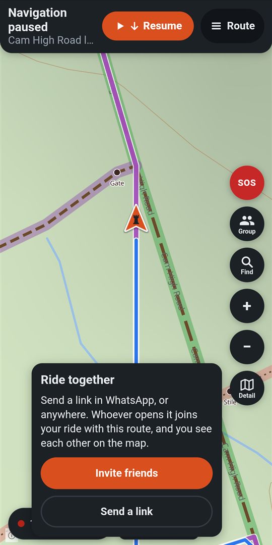
Premium to start one · free to join- Start a free ride or a route, then tap Group, Ride together.
- Invite friends: tick friends or a whole group, then Invite. They get a notice. Not a friend yet? Send a link.
- With RookWild open, the invite shows as a card on the start menu: Join or Not now. Otherwise they tap its notice.
- They tap Join the ride, then Ride it. Your route comes with the ride, and so do your sections along it.
- Everyone shows on everyone's map, named. Tap Group to see who's riding and when each was last heard from.
- Whoever starts the ride leads: leads by their name on the map, and Leads in the Group list. When the leader loads a route (More, Load route), taps Navigate me here or goes somewhere from Find, everyone following switches to it, with a note, and hears "Following Sam: heading to …" if prompts are spoken. Nobody needs the route shared first, and a rider who joins later gets it as soon as they set off. When the leader stops navigating (stops the route or the trip, gets to the end of a trip, or saves their ride), everyone following rides free, with a note, and hears "Sam stopped navigating" if prompts are spoken. Pausing, Just show the route and being rerouted change nothing for the others.
- Going somewhere else? In Group, tap Go my own way: your navigation stays yours. Follow leader switches you back to where the leader is going. Choosing a route or place yourself goes your own way too.
- Like the leader's route? Save … to my routes in Group keeps it.
- Leading and stopping for fuel? In Group, tap a rider, then Make leader. If the leader leaves, whoever has been on the ride longest leads.
- Done? Leave group ride, or just finish your ride.
On the phone only.
SOS
SOS tells your mates where you are and what's happened. On a group ride it tells the riders on it. Riding alone, it tells your SOS contacts, and only them: quietly if you're stuck or have a mechanical, with an alarm if you're hurt. It doesn't call the emergency services: Call 999 is on its panel for that.
- Hold the red SOS button until the ring fills. One second, or longer in Settings, Riding, Hold SOS for, so a knock can't set it off.
- Choose what's happened: I'm stuck, I've got a mechanical or I'm hurt. Or Cancel.
- No SOS contacts, and not said who should hear? I'm hurt asks: Alert all my friends or Just Call 999. Tap nothing and after 15 seconds all your friends are alerted. Stuck or a mechanical with no SOS contacts tells no one: the panel says so, with Call 999.
- See who's been told, and their replies. Ask them to come if you need them.
- Sorted? I'm OK, and tap again. It's over for everyone.
When a mate raises one: a card shows how far they are and which way, with Seen, I'll wait or On my way. If they're hurt, it fills your screen, with Open in Maps to get to them.
On a group ride, the same button sends quick messages: I need fuel, I'm hungry, I need a rest, slow up, I need to chat.
On the phone only.
SOS contacts
Up to five people who hear if you need help while you ride alone, and no one else. Free. They say yes first, and can step down any time. With none, you choose in Settings what happens if you're hurt: Alert all friends or Just Call 999. The first time you ride alone without any, RookWild asks.
- Settings, Riding, SOS contacts. Or from the question at the start of a ride: Choose contacts.
- Add a contact. Pick a friend and tap Ask at the top: they say yes in their app.
- Not a friend, or not on RookWild? Share an invite link and send it in WhatsApp or a text. They open it, get RookWild free, and tap Accept.
- With Premium, someone without the app: Add a mobile number, give their name and number, and Send invite. They're texted a link to say yes. If you're hurt or ask them to come, they get a text with a live link to where you are, and another when you're OK.
Asked to be someone's? SOS contacts, You're a contact for: Accept or No. Later, Step down. While they share where they are, you see them on your map, free.
Settings, Your SOS contacts: the same as on the phone. SOS itself is on the phone.
Just an SOS contact
Here only to be there for a rider? On the first welcome card tap To be an SOS contact, and Allow notifications. RookWild then shows only who you're an SOS contact for, where they are while they share it with Open in Maps, and their alerts: if they're hurt, your phone sounds an alarm even on silent, and the alert fills the screen with where they are and Call 999.
- Want the full app? Settings, Start riding. Same account; you stay their contact.
- Back again: Settings, Account, Just be an SOS contact.
On the phone only.
Report what's on the lane
- On the riding screen, tap Report.
- Choose: Blocked (a fallen tree, a flood, a locked gate), Closed (signed closed, a council notice), Damaged (deep ruts, washed out) or Hazard (livestock, shooting).
- Closed asks how long: Permanent (TRO), Temporary or Seasonal until a date (then Report closed), or Not sure.
- It's marked where you are, for every rider. No signal? It's sent when you have some.
Not there now? In Explore, tap the section or track, then Report on its card: it's marked on its line where you tapped. A route's card has Report too.
Reports show as round marks on the maps, and on the cards of routes and sections they're on. A closure says how long it lasts: Permanent closure (TRO), or Closed until 3 Nov. A permanent one stays until riders say it's gone. Reported by one rider, it's a Possible TRO until another says it's still there: a route along it is warned of it, but still goes that way. Once confirmed, finding a way keeps off it. Tap one: Still there or Gone keeps them right. Who reported it is never shown.
A route that passes a lane reported closed says so in red when you look it over and when you set off, as a lane marked with a TRO does. It's a warning: the choice is yours.
Riding towards a report, you're warned 400 m before it. With premium, following a route, you're told what's reported along it as you set off, and warned again about a mile before each.
Reports show as round marks on Explore, and on the cards of routes and sections they're on. To report one, tap the section or track, then Report on its card: it's marked on its line where you tapped. Closed asks how long: Permanent (TRO), Temporary or Seasonal until a date, or Not sure.
A closure says how long it lasts: Permanent closure (TRO), or Closed until 3 Nov; one only one rider has reported is a Possible TRO until another confirms it. A route that passes a lane reported closed says so in red on its card.
Your account
Your settings, bikes and plan are the same on your phone and the website.
Settings
In tabs:
- Riding: miles or kilometres, heading up or north up, spoken turns or tones, the arrow (big, small or none for each, its size, top or bottom), how close the riding map is, the colours of the lines, rerouting and when navigation pauses by itself, your SOS contacts and who hears if you've none, how long to hold SOS, battery saver, keeping the screen on (during a ride, or whenever RookWild is open: best for a tablet mounted and powered in a vehicle), hiding the phone's bars for more map (swipe in from an edge to see them), your garage, and lanes to avoid with no bike chosen.
- Maps: which map maps start on, your Home (a small house marks it, and Explore starts there when the phone doesn't know where you are; set it with Set your home by searching, Use where I am or Pick on the map; only you see it; on the riding map, tap the house for Navigate me here), the map key, what's kept for no signal, and your packs.
- Sharing: who sees your routes, rides, sections and stats, and who sees where you are when you share it.
- Account: premium, your account, Just be an SOS contact, sign out, help and tips.
When your sign-in has run out, the app keeps working: you can still ride and record, and your rides are kept. Anything that needs RookWild's servers (SOS, group rides, live sharing, syncing) darkens the screen to ask you to Sign in again, each time until you do; Not now carries on without. While you're riding, it only asks when you've tapped something yourself. Sign in again changes nothing on the phone. Under Sign out, Account says if any rides haven't gone up yet: they stay on the phone until you sign in again, then go up. Someone else signing in on the phone sees none of your routes, rides or packs.
Distances, which map maps start on, your Home (Explore starts there; set it by searching, Use where I am or Pick on the map; only you see it, on the website and the phone), what you ride, your garage, lanes to avoid, your SOS contacts, your packs, and who sees what. The riding settings are on the phone.
Your garage
Settings → Riding → Your bikes and their miles
Settings → Your garage: add or change bikes
- + Add a bike: its make, model, year and a nickname if it has one.
- Choose Adventure, Enduro or 4x4: it decides which grades you see.
- Save. RookWild keeps the miles, hours and rides for each bike, and in total.
Fuel range, including any spare fuel you carry: how far it goes on a full tank and any cans, in miles (or km, if that's what you chose). Type it under the bike's type when you add it or tap Edit. Stops along the route warns you of a stretch with no fuel longer than it. Leave it empty and a typical range for its type is used instead.
Sold one? Edit, and tick Retired. Deleting a bike keeps its rides.
On a 4x4: the garage holds your 4x4 beside any bikes. It's My vehicles, with + Add a vehicle.
Lanes to avoid
Settings → Riding → Your bikes and their miles → Lanes to avoid under a bike
Settings → Your garage → Lanes to avoid under a bike
Set once for each bike or 4x4. Whenever RookWild finds the way for you (Lanes too, Create a route, the way back to a route), it leaves these lanes out: yours, your packs', and the same lanes on the map.
- Choose the Hardest grade: Blue leaves out red and black lanes. Ungraded lanes are still used.
- Tap Save. Back changes nothing.
On a 4x4: also leave out lanes marked Narrow, Overhanging or Not for 4x4s. Narrow also leaves out lanes the map says are under 2.5 m wide, where it says.
Lanes under a TRO: always avoided. No setting changes that.
Your own sections: Use my sections where the map says no motor vehicles lets navigation use sections you made on a footpath, bridleway or restricted byway. It's off until you turn it on and confirm you have the right to use them: without it, that's an offence (Road Traffic Act 1988, section 34) and the police can seize the vehicle (Police Reform Act 2002, section 59). A section's card in Explore says whether it's used.
No bike chosen? Settings → Riding → Lanes to avoid sets them for each type. If no way keeps to them, RookWild says so, and Find offers Try without them.
Help, and your data
- Something wrong, or an idea? Settings, Account, Report a problem or idea. It comes straight to us.
- Check for updates: the newest version, from Google Play.
- The app says Please update RookWild? Your version is too old to work with RookWild's server. Tap Update and update it in Google Play. Your rides and settings on the phone are kept, and it only asks once a ride is saved.
- Your account: your name, Download a copy of all your data, or delete your account.
- Tips: On shows the tour and the tips again.
Problems and ideas: Settings, Account, Report a problem or idea in the app, or email jw@rookwild.com. Your data: deleting your account and the privacy policy.
See it on a real ride
The ride days show the features working together, from setting off to the cup of tea after.